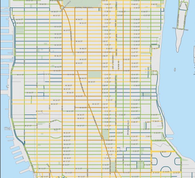
As part of the legally mandated Master Plan, the Pedestrian Group of the Department of Transportation is actually “planning” walk lanes. They developed a street classification based on pedestrian traffic demand. The classification prescribes the width of walk lane required to accommodate the pedestrian traffic. There is such a map for each borough.
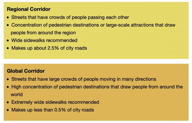
9th Avenue is classified as a “Regional Corridor” and 8th Avenue as a “Global Corridor” both calling for wide or extremely wide sidewalks.
Bravo! Such a tool never existed before for the walk lanes . This will be invaluable for the community to request sidewalk widening and objectively assess the adequacy of walking space before approving Open Restaurants.
The work is evolving. Drop us a note in the comments if you see a misclassification. Remember we are talking about pedestrian and not car traffic . (I know! it takes a while to adjust).