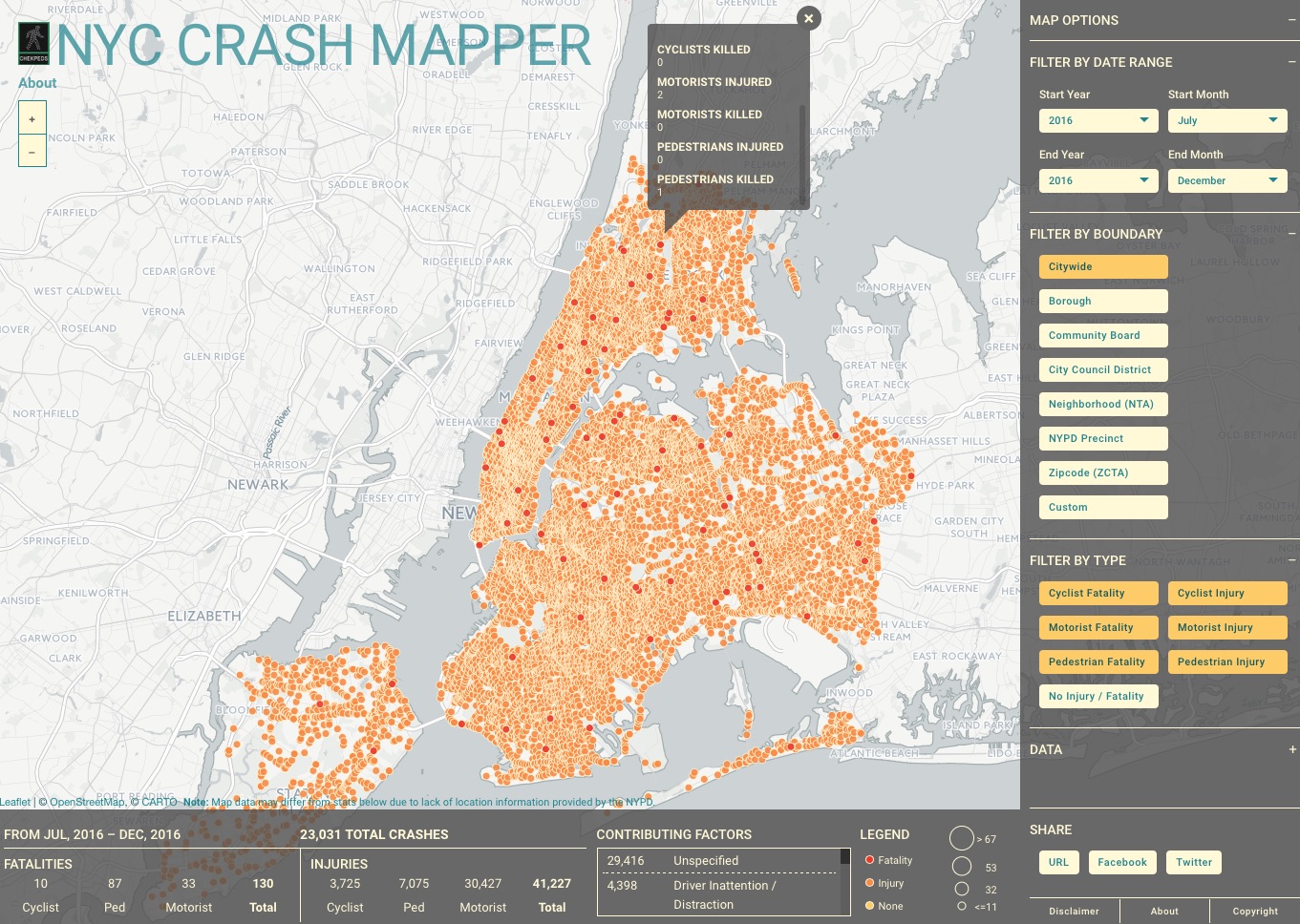
In March, CHEKPEDS launched a new mapping tool www.crashmapper.org that lets onefilter information by time slices, by areas like Council District, Community Board, Borough, Precinct, and by type of crash.
It’s distinctive feature is that it lets the user delineate a custom area to be tracked and returns map and statistics filtered by this area. This allows a non expert activist, like most of us are, to track a stretch of avenue and see if the safety situation is improving or getting worse, or track an area around a school and see if a slow zone is needed.
The reviews by experts have been very positive with the app called “Best in Class” by Streetsblog or the “Gold Standard ” by the creator of CrashStats, an early incarnation of this concept.
The app relies on NYC open data and refreshes as soon as it is updated. We thank Councilmember Corey Johnson for helping fund this effort and the CARTO company who gave us free space and tools. Chris Henrick assisted by John Kraus completed the app.
We hope that many activists groups, elected officials and others will find the tool useful to demonstrate to the DOT the need for safety improvements. If we are to achieve Vision Zero, we must all focus on the most dangerous intersections and use numbers in a smart way, without ever forgetting that pain and suffering for people and their families are behind these numbers.